

Er, uh, ahem... or was it 34 years ago and only 3,000 miles away... Yeah, right. That's when I started the journey that has led me to where I am today. I had recently graduated with a degree in Computer and System Engineering from an engineering school in upstate New York. I headed west to start my first fulltime job at NASA's main center for unmanned space exploration, the Jet Propulsion Laboratory in Pasadena, CA. Like most kids raises in those days, I was always interested in space. I remember huddling around our TV July 21, 1969 waiting to see Neil Armstrong's first steps on the moon. I had built several Estes rockets, and several scale models of Apollo rockets and the Lunar Module. My uncle had worked for Grumman Aircraft which built the Lunar Modules and over the years he had brought me many items from the program. Ah, I wish I still had that stuff.
Anyway, back to my story.
So you have probably guessed that I was on my way to JPL to work on some exciting space project. Well, no. I had been hired on to a secret military project that really had nothing to do with NASA and space. However, the department I was assigned to was the Image Processing Laboratory. This department was one of the pioneers of digital image processing; remember this is way before anything like Photoshop had ever been thought of. Back then even the simplest image manipulation would take minutes, even hours on just the smallest image. This lab had supported the image processing portion of all of NASA's unmanned flight up to that time; Ranger, Surveyor, Mariner, Viking and the early encounters of Voyager.
As I recall, I arrived in Pasadena during the 4th of July weekend, so my first day was the following Tuesday. Upon arrival things were a bit disorganized due to some unfortunate events that had happened just prior to my arrival. As such, an office had not been set up for me, so I temporarily moved into an office occupied by 4 or 5 other recent new hires. None of them were on my project, they were all hired to port the lab's image processing software to the "new, modern" Digital Equipment Corporation VAX 11/780s. What is a VAX you ask? Imagine a machine the size of a couple of mid-sized refrigerators and about 18,000 times SLOWER than the phone you probably have in your pocket. Oh, and you share t with about 30 other people; at the same time. But it did have an 80 character by 24 line CRT display! Gee, we've come a long way...
I was only in that office for a week before I moved to another temporary office, but that was not the last I would see of my first office mates; especially one of them.
But during those three years prior to our marriage, several opportunities and changes happened in our jobs. For me, that military project never really got going and I was pulled into various other projects in the newly titled Multimission Image Processing Laboratory (MIPL). One of the projects I worked on was to develop data visualization software; that is, programs that would take large amounts of abstract data and turn them into pictures that anyone could digest. Another department had developed terrain rendering software which combined digital elevation data and satellite imagery to produce 3-dimensional "photos" from anywhere in the landscape. I was asked to expand upon, generalize and integrate the software into MIPL's system. Think of Google Earth, but many, many times slower and much more difficult to use; but at the time it was state of the art. Here is our "crowning achievement" which took several weeks to plan and render; remember, at the time nothing like this had ever been seen. (I found this on youtube and I'm pretty sure the date is wrong, it was more like 1985.)
[youtube]6RsXCbpJG54[/youtube]
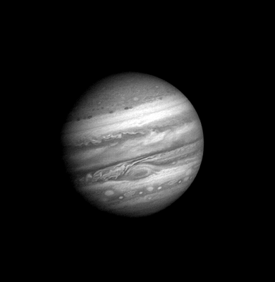
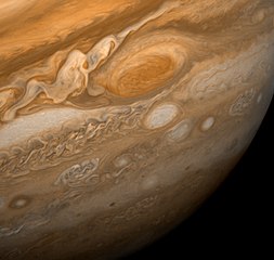
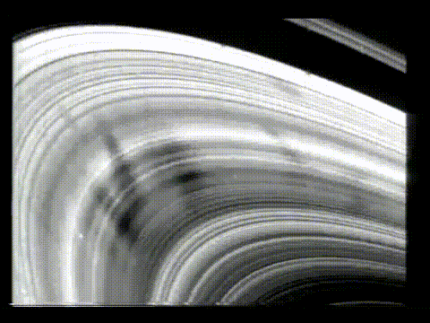
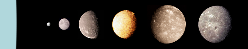
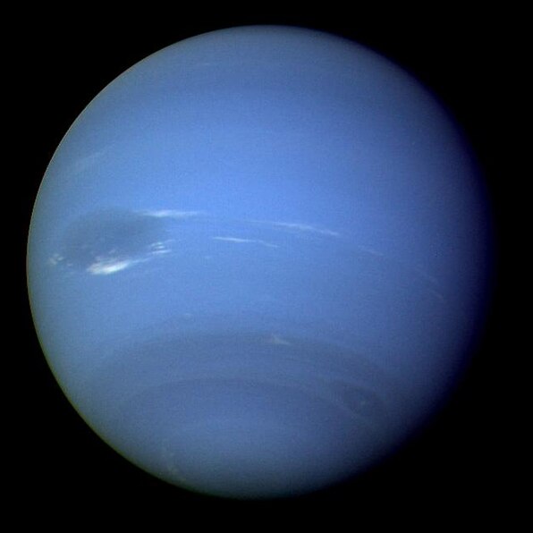
During this time, my soon to be wife transitioned from software development to mission operations and worked on image data processing for Voyager 2's Uranus and Neptune encounters. Imaging data from the spacecraft was sent to JPL where the operations team would process the data to produce the images that were ultimately turned into press releases. Processing included things like geometric correction, blemish removal, color enhancement and combining multiple images into to larger mosaics. The image processing team was the first to see these amazing pictures from far away places; and I was lucky enough to be working along side them (one in particular).
The United State Geological Survey (USGS) developed an algorithm to deduce digital elevation data from the sun angle, camera position, shadows, etc in satellite imagry. One of Voyager's closest encounters was with the Uranus' moon Miranda. The USGS applied their software to Voyager 2's "close-up" images of Miranda to produced elevation data. Then, my now very soon to be wife was asked to use my software to generate a simulated flight over the terrain of Miranda. Of course I was readily available for technical support. Here is the result of that effort (remember, mid-80's no HD yet).
[youtube]gZPgR4L6eug[/youtube]
We worked together on and off through the Uranus and Neptune encounters, although I technically wasn't on either project. A few years later I moved on to "greener" pastures. My wife stayed at JPL where she has worked on many missions including Galileo, Cassini and the Mars Rover missions. She continues to work there to this day.
So that's the story behind my choice for this build. Kind of a tribute to my wife and the beginning of our journey together.
Here is the kit:

and some PE:

In the next post I'll give some more background on the Voyager missions and follow that with the traditional sprue shots.